Sampleability and Facet Masking tools
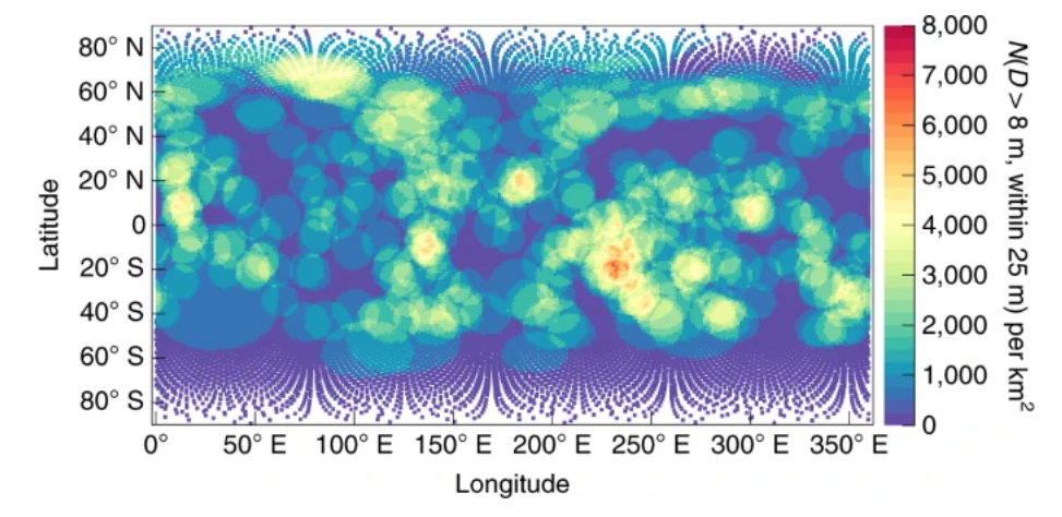
A series of tools were developed for mapping geologic features and other data onto facets of shape models. These tools, and some of their scientific products, are described in Walsh et al. 2019 and Walsh et al. 2022. They break down into three primary uses or flavors. First, is "proximity analysis", as shown in Figure 2 of Walsh et al. 2019, search and analysis of population of geology relative to each unit of surface area is produced. Second, is "facet masking" whereby mapped features (craters, boulders, ridges, color/geologic units) are mapped onto specific shape model facets allowing for rapid and flexible correlations between different data sets. Third, is "spatial analysis" of facet-masked data, such as a convolution based on a spacecraft expected landing ellipse to determine optimal spots for avoiding hazards or increasing the population of specific features.
Proximity Analysis