Venus SAR (Synthetic Aperture Radar) and Topography
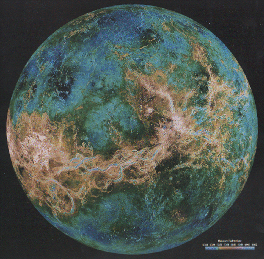
This image is of the eastern hemisphere of Venus (centered at 180 deg. E longitude) and shows a radar image of the planet overlain by topography. The elevated equatorial region displays the extensive chasmata of Aphrodite Terra. The minimum topographic elevation is 6048 km (expressed as planetary radius) and the maximum elevation is 6062 km. Blues are topographic lows, and reds and pinks are topographic highs.

Venus Global Topography
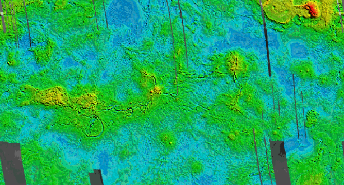
The large, scorpion-shaped elevated region at equatorial latitudes is Aphrodite Terra. Numerous chasmata are a part of or are linked to Aphrodite. The bright red area at the top of the image is Maxwell Montes, the highest mountains on Venus. The broad plateau to the west of Maxwell is Lakshmi Planum. The sides of the image are at approximately 30 deg. E longitude. Grey strips are gaps in the Magellan data; they have been filled with topographic data from the Pioneer Venus Orbiter.
Images courtesy of NASA and the Magellan Project.
last updated 1 May 1996