SUGGESTED HIKES WITHIN DRIVING DISTANCE
FROM RANCHO EUROPA
(Excludes hikes within walking distance of the ranch and hikes near
Boulder)
Last updated: 3 August 2003
NOTE: All hikes are less than 40 minutes drive from the Ranch, except for the Forest
Lakes hike...which is worth the drive. Hiking times are for leisurely hikers, taking time to
catch your breath, take photos,
and
appreciate the scenery. Fast hikers in good physical shape should be able to roughly
halve
the times. All hikes, except James Peak Lake, are shown on the Indian Peaks/Gold
Hill trail map #102 of
"Trails
Illustrated," available at many outdoor-sports stores and Ace Hardware in Nederland.
Road directions are approximate. Take sunscreen; beware of possibility of sudden
snowstorms or flash floods. Most hikes are at very high elevation; expect shortness of
breath.
Forest Lakes Loop along the Divide
Summary:
This is Lynda's favorite, despite the long, bumpy (but scenic) road
to get there.
Sublime lakes nestled in a cirque below the Divide; hikes above the lakes, and even up
around the Divide, afford spectacular views.
Description:
It is a short, half-mile hike down a couple hundred feet along a well-constructed path
to the first (largest) lake. Paths can be found that circumnavigate the lake. Along the
shore, and up on the slopes, there are often beautiful flower displays in summer months.
There are several ways to explore this region. We will mention two, although a short third
loop (shown in green on the map) gets you to another pretty pond and is an alternate way
to get up to the south of the lakes.
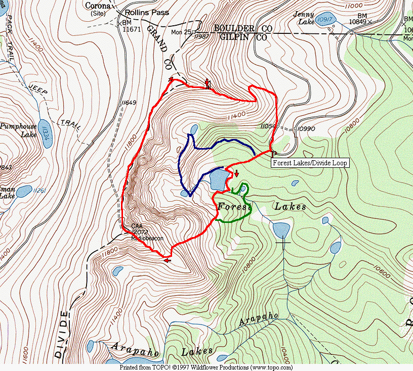 A lovely area to explore is west of the main lake, where there are two more perched lakes.
Access can be gained by climbing some talus that begins at the west side of the main lake,
where water may be draining from the first perched lake (which often has snow near it
even in summer). Climbing north up some steep grassy slopes from the northeast side of
the perched lake brings you to some high plateaus with beautiful views and, eventually,
down to another perched lake. From a few hundred feet south of the southeast end of this
northernmost perched lake, one
can descend steeply to the east-northeast into a grassy valley that leads you back to
approximately the half-way point along the original trail from the parking lot to the major
lake. (This loop, shown in blue on the map, can be taken in reverse.)
A lovely area to explore is west of the main lake, where there are two more perched lakes.
Access can be gained by climbing some talus that begins at the west side of the main lake,
where water may be draining from the first perched lake (which often has snow near it
even in summer). Climbing north up some steep grassy slopes from the northeast side of
the perched lake brings you to some high plateaus with beautiful views and, eventually,
down to another perched lake. From a few hundred feet south of the southeast end of this
northernmost perched lake, one
can descend steeply to the east-northeast into a grassy valley that leads you back to
approximately the half-way point along the original trail from the parking lot to the major
lake. (This loop, shown in blue on the map, can be taken in reverse.)
The more strenuous but rewarding hike is to climb up to the Divide and circumnavigate
the enormous "cove" in which Forest Lakes lie (red loop on map). We recommend a
clockwise route (see map). From the north point of the lake, proceed clockwise around the
lake to a point just short of where a large prominent boulder juts out into the lake. This
multi-branched route becomes especially complex near the outflow of the creek from the
SE point on the lake. There is a fairly large open area 100 feet E of the lake, with
boulders and firepits. If one proceeds SE for 35 paces to some water-loving bushes, you'll
see a faint trail doubling back to the west through the bushes. It curves around
counterclockwise to a point (if you keep looking to your right) where there is a crossing of
the outflow creek (two branches of the stream, both bridged by logs). After the last
crossing, keep as close to the shore of the lake as possible, proceeding clockwise around.
When you approach a "broken saguaro, benched tree" in a few hundred feet, just before the
jutting boulder, turn away from the lake and head uphill through a treeless swath of
meadow to the south. Part-way up, you can branch briefly to the left and continue uphill
within an open forest; the route emerges at the east end of a boulder field (scree slope).
Proceed south, then occasionally southwest around the boulder field (occasionally through
it, but keep to the grass and islands of trees) until you find a major, steep, flowered, grassy
hillside beneath a cliff that marks the northeast boundary of a major hill. There are some
giant boulders at the bottom of this grassy expanse. Climb up to the patches of trees, then
head SW up toward the highest peak (12,072) in the circque that marks the divide. The
hike to this point is about 1 hour. It was about another hour to the top of the cirque.
Head west-southwest toward the main 12,072 ft. peak, then angle back to the south or
southeast, eventually reaching the crest of the ridge to the south (which extends east from
the high peak) near the uppermost patch of dwarf tree shrubs. From the nose of this ridge,
there are fantastic views down to the south to Arapahoe Lakes and across to James Peak,
as well as the panorama out toward Mt. Thorodin and around to the north and below to the
Forest Lakes region and Needle Tunnel. Continue west-northwest, up the ridge to the top
of the peak. Then descend to the north and walk around the top of the cirque. Views are
splendid looking down across the patches of snow to the lakes below. The lands to the
west of the Divide slope down gradually to the road that connects Rollins Pass to Winter
Park. (The Winter Park ski runs are prominently visible to the southwest.)
 Continue
clockwise around the cirque to the final peak to the north-northwest of the lakes.
Follow the ridge that proceeds down to the east from that peak, which affords gorgeous
views in all directions. It reaches a "nose" perhaps 400 feet above the parking area.
Before the nose, there are patches of dwarf trees and shrubs, but there is little difficulty
finding paths between these otherwise impenetrable patches of growth. Several hundred
feet before actually reaching the nose,
clamber down the slope toward the north, trying to keep west of a major talus slope of
boulders.
Eventually, you can head east and circle around clockwise to the south until you encounter
the Rollins Pass Road just north of the short canyon-like road-cut at the south end of
which is the parking lot. (We are not sure that it is impossible to come down directly to
the parking lot from the nose, but it is probably steep and you may encounter cliffs...we
haven't tried it.)
Continue
clockwise around the cirque to the final peak to the north-northwest of the lakes.
Follow the ridge that proceeds down to the east from that peak, which affords gorgeous
views in all directions. It reaches a "nose" perhaps 400 feet above the parking area.
Before the nose, there are patches of dwarf trees and shrubs, but there is little difficulty
finding paths between these otherwise impenetrable patches of growth. Several hundred
feet before actually reaching the nose,
clamber down the slope toward the north, trying to keep west of a major talus slope of
boulders.
Eventually, you can head east and circle around clockwise to the south until you encounter
the Rollins Pass Road just north of the short canyon-like road-cut at the south end of
which is the parking lot. (We are not sure that it is impossible to come down directly to
the parking lot from the nose, but it is probably steep and you may encounter cliffs...we
haven't tried it.)
The entire loop is about 3 miles long. The elevation gain from the lake is nearly 1300
feet, and perhaps 1100 feet above the parking area. It is scenic beyond compare and is not
terribly strenuous, given the steep slopes and inherently high elevation. Be wary of
adverse weather conditions along the Divide.
How to Drive to the Trailhead:
The drive to the trailhead, via Rollinsville,
Tolland, and the old Moffat train route takes at least 1 hr 15 min when the road is in its
often fairly rough condition. The poor quality of the road surface can begin within a
couple of miles west of Rollinsville. It gets much worse after one turns to the right (east)
of the Moffat Tunnel Road toward Rollins Pass. Still farther along, a couple of miles
before Yankee Doodle Lake, it can be marginal for a passenger car. A little over a mile
past Yankee Doodle Lake, park on the left just before the road curves to the right and
enters a narrow, single-lane canyon-like road-cut. This is the Forest Lakes trailhead, at
11,000 feet.
Front Range (Boy Scout) Forest Trail west of Magnolia Dr.
Summary:
Pleasant, varied, easy stroll from a trailhead only a 5-minute
drive
from the ranch,
with a rewarding view of the Continental Divide at the end (actually, it has become less
rewarding since this was first written: a U.S. Forest Service tree-thinning project has
converted much of this region into an eyesore that won't look pretty again for years).
About half-an-hour each
way.
Description:
Beyond the gate, the closed-off road meanders gently
upwards
through open stands
of pine and aspen, with occasional meadows. There are frequent glimpses and
occasional
views of rocky
ridges and distant peaks. About a mile in, the road (FR 357) curves to the right in a broad
open
area dominated by
an interestingly shaped rock about 20 feet tall.
One can leave the
road and continue west a few hundred feet to a wooded ridge that forms the lip of
Boulder Canyon.
From some open regions along the ridge, there are gorgeous views across the canyon
to the
white-capped
peaks of the Continental Divide. The road turns into a network of bike trails, one of
which curves around to the northeast to the flank of a rocky outcrop; bushwhack up to the
top (starting from where the bike trail leaves aspens and re-enters the ponderosa forest) for
fine views.
A region a couple of miles west of this trail can be accessed from Magnolia Road,
about 2 miles west of Lazy Z, at the top of a short climb where the road turns sharply
to the left. Park here and follow closed Forest Road 606 either clockwise or
counterclockwise around the hills (less than a mile). Nice views of meadows, hills,
and open country. A detour on mountain-bike trails to the west and north leads to
several overlooks of Boulder Canyon and Barker Reservoir. (These trails are partly
on National Forest lands, partly on the newly acquired Reynolds Ranch Open Space.)
If you proceed down Forest Road 606 from the parking area (beginning the
counterclock-wise loop), a trail branches to the right, down into the valley, shortly past the
abrupt end of
the forest on the right. After an S-shaped traverse in the bottom of the valley, the "Blue
Dot" mountain bikers trail gradually ascends the mountainous region to the east. We have
crossed over this region to connect to the original trail described at the outset, but a topo
map is essential since the trails are indistinct in this area. Views from the top of local
peaks in this area are spectacular.
How to Drive to the Trailhead:
Half a mile north on Magnolia from the
intersection with Lazy
Z there are trail signs on the west side of the road. A dirt spur road goes in about
800 feet
to a gate, but
the road is badly rutted only 200 feet from Magnolia, so we recommend parking near
Magnolia.
Walker Ranch Loop Trail
Summary:
An easy-to-reach, nearby, 7.8-mile-long loop through a wonderful
variety of terrain. Only moderately strenuous, the loop is at relatively low elevation and
most of it may be snowfree during much of the winter. (The parking area is at 7300 ft.;
the bridge crossing South Boulder Creek near the intersection with the El Dorado Canyon
trail is about 6400 ft.) The downside is that the trail is popular with hikers and mountain-
bikers and may be crowded on weekends. NOTE: A devastating fire burned most of
the region within and northwest of the loop trail in mid-September 2000; when the trail
reopens, it may provide first-hand views of the damage that can be done by an out-of-
control wildfire, but will be less pastoral and pretty than it used to be.
Description (before the wildfire):
We'll describe the loop going clockwise. The
loop is really 7.8
miles long, although the sign at the Cresent Meadow trailhead has different numbers
(probably roundtrip mileages to the two points mentioned). The first few hundred yards is
a foot-trail down through pine forest that parallels the adjacent Gross Dam Road. Soon,
the route follows an old road that diverges from the main Road. Views can be had from
time-to-time across to Gross Dam, Castle Rock, and South Boulder Mountain to the
northeast. The trail descends gradually but continuously, reaching South Boulder Creek a
mile from the parking area. For the next half-mile or so, the nearly level trail parallels the
north side of the creek, a lovely creekside walk.
Just before the intersection of a small creek with the main one, the trail diverts to
the north and begins a 1.5-mile climb to the parking lot off Flagstaff Road. This is the
least pleasant part of the loop, and would be even more so in hot weather since it would be
a relentless climb up a hot, south-facing slope. (It's not especially steep, however, being
negotiable by trail bikes. It remains an old auto track.) Partway up, the views improve
and the trail comes close to a rocky knob between Castle Rock and Langridge Dyke.
The remainder of the route, beyond the Flagstaff Road parking area all the way
down and around to the Cresent Meadow parking area, is shown with poor accuracy on the
"Go Boulder -- Open Space/Parks and Trails Map". To start with, instead of climbing
between two peaks, the trail (now a real hiking and biking trail rather than an old road)
skirts around the south side of the peaks (with modest elevation gain) and then proceeds
east along a ridge before descending on the short switchbacks down a north-facing slope
(which may be icy in winter). At one point before the switchbacks, there is a crest (with a
trail marker nearby) where one first sees the subdivision north of Walker Ranch. At that
point, a not-prominent mining road takes off to the southwest, which gently climbs to a
rocky outcrop (where we had lunch) with marginal views of the Divide to the west and
magnificent views from Mt. Starr counterclockwise around through El Dorado Canyon to
South Boulder Peak and Green Mountain.
At the bottom of the switchbacks, the trail follows an intimate gulch to the
intersection with the Bison Road trailhead. At that point, we followed an old road (with
buried gas pipeline underneath), trending southeastward, which undulates gradually
downward (then more steeply) to the intersection with the El Dorado Canyon trail. A few
hundred feet beyond, one reaches the chasm of South Boulder Creek (upper stretch of El
Dorado Canyon). A wide footbridge crosses the canyon to a spectacular rocky region next
to a series of small falls. At this point, the trail diverges from South Boulder Creek by
climbing the southeast wall in a series of steep but well-constructed staircases.
The trail reaches a level ridge, which trends southwestward and affords wonderful
views back towards South Boulder Peak, down to El Dorado Canyon, and across to the
railroad track hugging the southern side of the canyon. Then the trail ascends, very
gradually to the west-southwest, keeping a few hundred feet below and to the north of the
crest of an east-west-trending ridge, affording views across to the railroad tracks and down
into Johnson Gulch -- but there are never any views north into the South Boulder Creek
canyon. (This differs from the map, but it is apparently a new route for the trail, designed
to be free of snow as much as possible. The new foot- and biking-trail is very smooth and
has gentle grades, although the views aren't as spectacular or interesting as elsewhere
along the loop.)
After going through a particularly dense grove of towering trees, the trail gradually
ascends into more sparsely forested terrains, finally emerging into the Crescent Meadows.
It climbs gradually toward the parking area, with the busy train tracks not far to the north.
How to Drive to the Trailhead:
Allow about 25 minutes. From the Ranch, drive
to the intersection of Lazy Z with Magnolia, bear left and immediately bear left again on
Forest Rd. 97. Turn left on paved SR72 and proceed several curving miles through
Pinecliffe and Wondervu. A couple miles east of Wondervu, look for the sign for "Gross
Dam" (by the United Power station) and bear left on the dirt road. Follow this road down
for 2.5 miles to a turnout on the right, soon after crossing railroad tracks. This is a well-
developed parking area for the Crescent Meadow trailhead (it is actually in a section of El
Dorado State Park, but no fee is charged). (Two other trailheads can be reached via
Flagstaff Rd. from Boulder.)
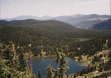
Diamond Lake Trail from Fourth of July Trailhead
Summary:
This is a lovely, short hike (half-day roundtrip, 2 miles each
way) in
high mountain
country, with a variety of views and places -- waterfalls, a lake nestled beneath snowy
peaks, meadows,
expansive vistas. The route up is about 2h 40m, the return about 1h 40m. The
starting
elevation is about
10,000 ft.; Diamond Lake is at nearly 11,000 ft. This is a highly recommended hike
although it would be
particularly special on a weekday, for it can be quite crowded on a sunny weekend
day.
Description:
The well-built trail ascends
steeply from the upper (north)
parking
lot, then
gradually becomes more level as it threads up into the valley along the flank of a
mountain
above a fork of
Middle Boulder Creek. There is a single pair of switchbacks (not two, as suggested
on
some maps) before
the trails divide (Arapahoe Pass or Diamond Lake). Before the juncture, the trail
crosses
several streams
(one quite major), and a single recent site of an avalanche which has broken off the
trees 5
feet above the
ground down into the valley. The first half of the trail is occasionally in deep forest,
most
often in
scattered forest, and sometimes in open mountain-side meadow.
At the juncture, the Diamond Lake Trail proceeds mostly on the level for
quite a
distance, then
descends to the creek. Just upstream before crossing the creek is a beautiful view of
cascading waterfalls.
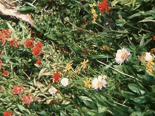
In July, the wildflowers were profuse, varied, and beautiful. The first half of the hike
affords increasingly
striking views of the snowy peaks immediately north of Devil's Thumb. Along the
whole
trail, there were
numerous streams, but one was rarely in danger of getting one's boots submerged in
water
in July.
After crossing the creek, the trail is level for a while, then proceeds up
through a fir
forest to the
lip of the plateau that holds the lake. This route had patches of snow, and a little
mud, but
was otherwise
easy -- with only occasional views across to the north side of the valley. Upon coming
up
on the lip, there
is a gorgeous meadow, with snowy mountain vistas beyond to the south. Shortly after
crossing a log
footbridge, the trail hit a high (5 foot deep) area of snow when we went in July; the
final
500 feet south to
the edge of the lake was entirely on packed snow, which presumably lasts throughout
the
summer. One
can circle counterclockwise to the egress of the stream flowing out of the lake (just
above
the cascading
waterfall that can be seen from across the valley on the ascent).
How to Drive to the Trailhead:
Proceed west on Lazy Z to Magnolia
Drive.
Bear left on
Magnolia and continue to its terminus at the paved Peak-to-Peak Highway. Turn
right and
descend toward
Nederland. As you enter the outskirts of Nederland, look for the Eldora turn-off on
your
left. Proceed
(slowly) through the town of Eldora (do NOT take the lefthand branch that goes up
to
Eldora Ski Area).
Shortly after Eldora, the road becomes dirt. In half a mile, there is a turn-off for the
Hessie Trailhead (do
NOT take), and many cars may be parked on the road at this point. Continue about
5
miles to the end of
the road at Buckingham Campground and the Fourth of July Trailhead. The road to
the
trailhead was easy
for our new RAV-4, but it becomes rougher -- though passable for a passenger car --
in the
last couple of
miles. It is about half-an-hour drive (15 miles) from the ranch.
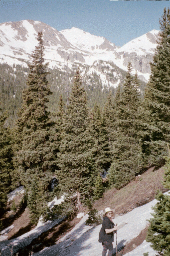
Trail to Arapahoe Pass
Summary:
Close, easy walk to the Divide. Climb out of flowery
meadows, follow an old
mining road above treeline, and emerge to a spectacular viewpoint, with trails
radiating to other
interesting, nearby places above 12,000 feet (e.g. Lake Dorothy). 2000 ft vertical
elevation gain from
Fourth of July Trailhead to the lake; 3 hours up, 2 hours back. Since the whole
length of the trail is
carved into a south-facing slope, this is a relatively snow-free way to get to the Divide.
Description:
See description of Diamond Lake Trail (above) for first
mile. After turning right
and getting boots wet in water flowing in trail, there are wildflowers and open vistas
until trail emerges
onto a plateau, containing the Fourth of July Mine and facing the south facade of
Aprapahoe Peak; there
is a forest of small, struggling trees near timberline. Above that, the trail follows a
narrow, old mine road
up the valley, with nice views below and across to snowy peaks. At the pass, there are
great views of
serrated peaks northwest of Arapahoe Peak, Caribou Lake nestled in a green basin
below, and the
forbidding jagged peaks of nearby Neva Peak to the southwest. Climb a quarter mile
up the Caribou Pass
trail, and you come to the cold Lake Dorothy, at the base of Neva.
How to Drive to the Trailhead:
See Diamond Lake (above).
Trail to James Peak Lake
Summary:
This is a gorgeous, short hike to a lake at the foot of massive
James
Peak...but
getting to the trailhead takes a while (and requires high clearance, preferably
4-wheel-drive). The trail
(entirely above 11,000 ft.) is about one mile each way; allow 40 minutes down, an
hour to
return.
Description:
The trail begins on a
barren bluff above treeline (11,600
ft), from
which there is a
majestic panorama, with James Peak looming before you beyond the valley that
proceeds
east-
northeastward from the Lake at its base. To the north are other peaks of the
Continental
Divide. The well-
built trail descends rather steeply down the side of the bluff, reaching the valley after
half-a-mile (from
where another trail branches right; it goes to a larger lake and then up to the Divide
and
James Peak). In
the valley, one is just barely down in the trees, with marmots scampering over
interspersed
rocks. Across
flowery meadows, there are views of the stream and its associated waterfalls and
ponds, a
few hundred
yards to the north. The trail is fairly level, although it climbs again slightly to a lip
that
contains James
Peak Lake. The lake, at 11,200 is almost precisely at treeline, where a few scrubby
trees
give way to
ground-hugging bushes and meadows, with rock scree just above.
How to Drive to the Trailhead:
About
20 miles; allow an hour. Return
to Magnolia on Lazy
Z, bear left and
continue to where
Magnolia terminates at the paved Peak-to-Peak highway. Turn left (south) and drive
to
Rollinsville (a
couple of miles -- beyond the C72 intersection and a small lake). Take the graded
dirt
road west out of
Rollinsville a few miles to the hamlet of Tolland (note 15 mph speed limit in
Tolland). Just past Tolland,
turn left on the
road
toward Apex.
After a few miles, there is a prominent intersection with the road that continues east
toward Apex; instead,
take the road west (signed "4-Wheel Drive" -- but a good passenger car will make it
much of the way)
that generally follows
a ridge toward James Peak. Halfway to the trailhead, the road rises above treeline --
thereafter it is narrow
and rocky as it follows a contour along a barren hillside to the broad parking area at
the
trailhead (the last section of road requires high clearance, but we saw a
Honda Civic at the
trailhead; the
continuation of the road up the hill to the south is impassable except to 4-wheel-drive
vehicles).
Continental Divide: Rollins Pass to Hessie.
Summary:
Long, spectacular, relatively level or downhill one-way hike
along
the Continental
Divide, then down through beautiful country. Involves a 2-car shuttle. The hike itself
is
about 11 miles
long about 7 hours). It begins at about 11,000 feet, ascending to over 12,000 feet,
then
descending to
about 9,000 feet. Allowing for retrieval of both automobiles, leave at dawn and
expect to
return well after
dark, even when the days are long.
Description:
Shortly before the closed tunnel, ascend the bluff to the
left of the
tunnel, to some
ruined stone houses. From there, follow the contour of the land over to the Boulder
Wagon Road, which
ascends another hundred feet, or so, before dropping down to Rollins Pass (the
railroad
bed, a few hundred
feet below, might be an equally reasonable alternative). The scenery is barren and
stark,
above the treeline
-- the ridge of the Continental Divide that you will be hiking along forms the
northwestern
skyline across a
deep valley. A cascade of water drops into the valley below Lake Betty.
From the pass (with its historical signs by a parking lot, which vehicles can
reach
by a
road from Winter Park), proceed northwest and ascend a steep section of the
National
Scenic Trail
(Continental Divide Trail) with occasional excellent views of King Lake and
snowfields
below. Hiking
maps show the Divide trail and the High Lonesome trail either passing along the
divide or
down a few
hundred feet to the west, but there is little precise resemblance between the various
trails
(with prominent
cairns) on the ground and the maps. We recommend trying to stay close to the
Divide,
although it is
advisable to circumvent some of the higher peaks. The talus looks forbidding, but it is
quite easy to hop
from rock to rock.
Be careful not to miss the intersection with the Devil's Thumb Trail just
before a
high bluff (signs
are missing). The views from the Divide where the Devil's Thumb trail drops down to
the
east are quite
spectacular. From that point down to the small lake above Devil's Thumb Lake, the
trail
is very steep (it
would be lung-stretching, indeed, climbing up, in the opposite direction). At Devils's
Thumb Lake, one
reaches the treeline (and beautiful flowers); don't miss the profile view of Devil's
Thumb
itself from a
distance of less than half a mile (prior to this, the Thumb is not recognizable since it
is
projecting toward
the south). Although the trail is fairly shallow-sloped below Devil's Thumb Lake, it is
quite rocky as well,
so it's a bit slow. There are occasional confusions: when the choice is between a trail
and
an old road, we
recommend the trail. One exception is at the southeast end of Jasper Lake, where
the
foot-trail crosses a
very wet and full stream, but the dry route across the dam's spillway is fine. The old
road
east of the
spillway eventually connects with the trail again.
The descent is very pretty (several small lakes in addition to the larger ones
on
maps, high
mountains on left and right). After reaching lower elevation, we chose the Devil's
Thumb
Bypass trail to
the left (which bypasses any stream crossings and is often out in the open, with views
of
the surrounding
mountains and aspen groves), rather than the regular Devil's Thumb Trail. The
bypass
meets the regular
trail again at a bridge by a roaring fork of Boulder Creek. From this point, it is a
long
mile back to the
Hessie Township.
How to Drive to the Trailheads:
Leave one car at or near the Hessie
trailhead,
the second at the
end of the road toward Rollins Pass from Rollinsville.
Directions to Hessie: This is an easy, short (15 minute) drive from
the
ranch. Proceed west
on Lazy Z to Magnolia Drive. Bear left on Magnolia and continue to its terminus at
the
paved Peak-to-
Peak Highway. Turn right and descend toward Nederland. As you enter the outskirts
of
Nederland, look
for the Eldora turn-off on your left. Proceed (slowly) through the town of Eldora (do
NOT
take the
lefthand branch that goes up to Eldora Ski Area). Shortly after Eldora, the road
becomes
dirt. In half a
mile, there is a turn-off for the Hessie Trailhead, with many cars often parked on the
road
at this point. If
your car has high clearance and it is past the wet season, it is possible to drive in half
a
mile, through a
stream, to the Hessie townsite (abandoned) where there is ample parking.
Four-wheel-drive vehicles can
continue another quarter mile to the actual trailhead, but parking is limited.
Directions to east side of Rollins Pass (allow 3 hours roundtrip from
Nederland due to
rough dirt roads): Return to the outskirts of Nederland, turning right (south) on the
Peak-to-Peak Highway;
a couple of miles past Magnolia Drive (beyond the intersection of C72 and a small
lake)
you enter the
small town of Rollinsville. Turn right on the main east-west road (a well-graded dirt
road). Well beyond
Tolland, the road crosses to the north side of the valley. Take the righthand turn-off
to
Rollins Pass, NOT
the main road to the terminus of Moffatt tunnel. The road becomes very rough
several
miles before
Yankee Doodle Lake and becomes narrower and even more difficult above the lake,
but it
is passable
(slowly and with care) by passenger cars. The road is closed (by huge boulders)
several
hundred yards shy
of the collapsed Needle Eyes Tunnel. Park here. (Note: about a mile shy of the end of
the road, there is a very narrow, one-vehicle-wide section of road between two high walls.
Just south of that is parking for a trailhead. The trail descends to the first of several
"Forest Lakes", a beautiful area for short day hikes.)
Lost Lake (above Hessie).
Summary:
A half-day hike on a popular trail past cascading streams and
a
mountain vista
viewpoint to a pretty lake. The hike is in a valley below "backside" ski runs of Eldora
Resort. About 5
miles roundtrip, 3 to 4 hours. Elevation gain is 800 feet (to 9800).
Description:
At the trailhead, a substantial footbridge crosses a rushing
stream
and the trail
(actually a road) begins in earnest. As it bends to the north to curve up onto a
hillside, a
footpath heads
directly up through the meadow at a steeper incline. Take the road up, the path on
your
return. Several
hundred feet beyond the place where the footpath rejoins the road, one hears the
thunder of
the tumultuous
rapids (called a "waterfall") which can be reached by descending a couple hundred
feet off
the trail to the
left.
The dirt road continues upwards to the west, then levels out and bends to the
southwest. Cross the
next bridge over a torrent of rushing water. A little above the bridge is a smaller
waterfall.
The walking can be a bit treacherous (if the trail is still snow-covered early in
the
season) in a
thicket of bushes, trees, and unstable snow, near the point where the stream from
Lost
Lake intersects the
major stream. Not far above that point, the trail reaches a saddle, with nice slabs of
rocks
to the right from
which there is a view of peaks of the Continental Divide above some rapidly growing
aspens.
It is at this point that the Lost Lake Trail branches up to the left. Less than
a
quarter mile up, a
small sign indicates horses should bear to the right (which is where the map shows the
trail
bending right).
But we suggest taking a small footbridge across the Lost Lake drainage and into
woods
just north of the
lake. A few switchbacks suddenly brings you to the lake. Across the small lake is a
massive, snowy
edifice, with obvious mine tailings.
Alternate Loop via Devil's Thumb Bypass Trail:
This is a 5-mile loop from
Hessie township (elevation gain is 1000 ft.). At the point
mentioned above where the Bypass Trail takes off to the right (just before the bridge),
climb up steeply through the
forest until you emerge into meadows with a glorious, panoramic view of the Divide
before you. There is a long,
spectacular walk through the meadows until the trail dips into trees again. Turn left when
the trail rejoins the main
Devil's Thumb Trail. Several hundred feet downhill, you come to the rushing stream
(South Fork Boulder Creek);
detour a hundred feet to the right to a well-built footbridge. The trail proceeds almost on
the level to the Lost Lake
trailhead, generally hugging the south side of the meandering creek. Return along the
route described above (or first
take the side trip up to Lost Lake).
How to Drive to the Trailhead:
Follow directions to Hessie for previous
hike.
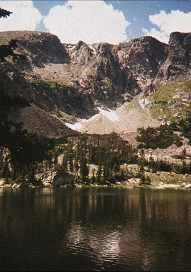
Isabelle Lake and Isabelle Glacier.
Summary:
Wonderful, popular hike past several lakes to a glacier
nestled
beneath some of the
highest of the Indian Peaks. The trail itself is mainly straight, with less variety than
some.
But the lakes
and glacier are especially rewarding. Begins in the Brainard Lake area (Longs Lake
parking lot) at 10,500
feet; final climb to the glacier is above 12,000 feet. 8 miles roundtrip; allow most of a
day. A shorter, easier hike is to turn around at Lake Isabelle: 4 miles roundtrip. Likely to
be
snow-covered until July, with possibility of new snowstorms in September.
Description:
Five minutes in from the Longs Lake parking lot, take a
very
short detour to the
left to gaze out across the length of Longs Lake to the craggy Continental Divide to
the
west. Most of the
well-worn main trail along the north shore of the lake is far enough back in trees that
there
are few
opportunities for a good look at the lake again. About 2/3rds of a mile past a
junction with the Jean Lunning Trail (which circles back around the south side on Long
Lake; this is a less crowded, well-built trail giving better views of Longs Lake, the
mountains to the west, and lovely meadows and streams in the foreground, and provides
only slightly longer access to the Pawnee Pass/Isabelle Glacier Trails), the trail ascends a
couple of switchbacks,
past some rushing torrents, up to the banks of Lake Isabelle. (This is a popular and
gorgeous spot; one can step across the top of the waterfall cascade emanating from the
lake to the less crowded south shore and gaze at the nearby Divide across the lake.) After
this teaser, the lake
disappears from view
for a few minutes until the trail arrives at a spectacular view southwest across the lake
(near here, the
Pawnee Pass trail forks to the right). Thereafter, unlike the Longs Lake part of the
trail,
the trail is right
next to the lake along most of its length, affording spectacular views in all directions
as the
forest thins out.
(Hiking guides say that Isabelle Lake is sometimes drained in August, in which case it
would be much less
pretty.)
Near the northwest part of the lake, the trail becomes temporarily difficult to
follow, with several
branches attempting to cross wetlands (and they are very muddy) and others requiring
that
one pick one's
way across talus boulders, which impressively cascade down the steep slopes to the
north.
To this point,
the trail is broad and level or gently uphill almost the entire way from the parking lot.
It
then narrows and
climbs up two steeper sections, the first past a lovely waterfalls just a few steps off the
trail. Finally, one
emerges on top of an upper plateau, with braided streams meandering among
boulders and
tufts of grass.
The trail picks its way across these to the southern slopes of the valley, where the trail
keeps above the
bogs, climbing somewhat until it reaches the lake that is at the foot of the perched
Isabelle
glacier. This
upper stretch can have patches of snow, even in mid-summer.
The little lake is situated in a spectacular cirque of towering mountains.
Continue
along the
northern shore of the lake, watching for the trail to begin its steep switchbacks up the
talus
to the glacier.
This last stretch up to the glacier is very steep, gravelly, and exhausting at elevations
near
and above
12,000 feet.
How to Drive to the Trailhead:
Allow 40 minutes. Drive west on Lazy
Z to
Magnolia, bear left
and continue to its terminus at the paved Peak-to-Peak highway. Turn right and drive
to
the traffic circle
in the middle of Nederland. Circle counterclockwise to the 10 o'clock branch toward
Estes
Park. Just
beyond the town of Ward, look for the Brainard Lake turn-off on the left. An
entrance fee
is collected at a
booth half-way to the parking lots. At the far end of Brainard Lake, a turn-off
ascends and
then branches
to two major parking lots; take the lefthand branch to the Longs Lake lot.
Note: the road into the Brainard Lake parking lots is closed during the winter
near
Red Rock Lake
(if not even further down the road); it is opened rather later than necessary in the
spring
and closed at the
first excuse in the autumn. Once closed, it is at least 2 miles of additional hiking to
get to
the trailheads. On busy weekend summers, the Longs Lake lot is filled early in the
morning. An alternative place to park is further along the loop road around Brainard Lake;
a spur trail connects directly to the east end of Longs Lake and continues as the Jean
Lunning Trail.
Mitchell and Blue Lakes, Continental Divide beneath Mt. Toll
Summary:
Spectacular alpine scenery in the Indian Peaks Wilderness.
An
alternative to the
Isabelle Lake trail that is more varied and provides an opportunity to ascend to the
Divide.
Five miles
roundtrip from Mitchell Lake parking lot (10,500 ft.) to the far end (northwestern) of
Blue
Lake (over 2
hours in, 1.5 hours return). From Blue Lake (about 11,300 ft.), it is a strenuous but
rewarding 2 hour (or
more) additional round-trip climb, off-trail but above timberline, to the Continental
Divide
at a saddle
(12,400 feet) just north of Mt. Toll. Best time to avoid snow: mid-July to
mid-September.
Description:
The level trail leads from the parking lot through a forest
to a
footbridge that
crosses a major creek. Bear left, past an Indian Peaks Wilderness sign some distance
to an
abrupt
righthand turn toward the eastern end of Mitchell Lake (maps of the trail show a
somewhat
different route,
closer to the creek -- it is easy to get lost if the ground is snowpacked). Proceed
along the
southern edge
of the lake and cross the braided stream entering its southwest corner. The trail
ascends
through a bit of
woods, then climbs a gentle hill (not the talus slope to the left!) to a swampy area
that
feeds a smaller lake
west of Mitchell Lake. Beyond that, near an immense cairn, there are majestic views
of
Mt. Toll and other
mountains to the west and south, with broad meadows, open forests, and a string of
small
lakes connected
by the stream emanating from Blue Lake. The trail keeps to the north side of the
stream
and emerges
above timberline below Blue Lake. Well-marked cairns lead to the east end of the
lake.
A good path proceeds counterclockwise around the lake, climbing to a small
bluff
at the northwest
end. A bit higher than that, there is a large lunch spot next to a rivulet of water
cascading
through patches
of flowers, affording views of a waterfalls that empties into the west end of the lake
(it
drains a large
snowbowl immediately north of Mt. Toll).
The recommended route to the Divide starts from the lunch spot and tends to
keep
atop talus-free
ridges, which would not be true of the talus-filled valley through which the
waterfalls-feeding stream runs.
Angle up from the lunch spot, across the rivulet and ascend the next cliff via another
small
valley. At this
point, low ground-hugging "trees" must be circumvented by following a line of talus
rocks
(this is the last
place that plants are a problem -- beyond that, one is reliably above the treeline).
The next
major edifice is
composed of en echelon layers and ledges sloping gently up to the left. It is easy to
ascend the bluff using
the ledges as a series of ramps, emerging onto a grass/tundra covered broad ridge that
ascends toward Mt.
Toll, but gradually levels out. At this point, keep away from the edge overlooking the
stream, but instead
head for the base of a small cliff that borders the grassy area on the north. The cliff
gradually peters out
and becomes the lip of a valley to the north in which the next lake sits back towards
the
mountain ridge
farther north. The lip provides good access to the next bluff (above the upper level of
the
water falls, just
below the end of the snow bowl). There is a short section of additional
talus-block-hopping until one gets
atop the bluff, which turns out to be the end of a tundra-topped ridge that runs
west-northwest towards the
right side of the snowbowl. It is a very convenient route to the foot of the final talus
slope
before the
Divide.
The talus slope is steep but it is a fairly easy route (in terms of footwork -- it
is a
steep climb
requiring frequent stops to catch your breath): aim for the larger, more secure blocks
and
try to avoid the
slippery snow. You finally reach a rocky cliff that is easy to walk along until the place
to
make the final
20 foot ascent to the Divide. You emerge 20 feet above a little winding canyon that
may
provide a lower
route to the western side of the divide (except that a large snow drift blocks the way).
This spot on the Divide provides totally stunning views, although it is not
quite like
being on the
top of the world. Indeed, only a small part of distant lands to the west are visible.
The
view southwest is
dominated by another range of 12,000 foot mountains a few miles away -- they are
extremely jagged and
very snowy on their NE faces. Mt. Toll towers above to the south, and the snowbowl
dives away below to
the east, down toward Blue Lake, which looks very far down from this vantage point.
It is
an enthralling
and stunning vista, although your body feels oxygen-deprived.
How to Drive to the Trailhead:
Follow directions for Lake Isabelle,
except
branch right to the
Mitchell Lake parking lot (instead of left to the Longs Lake lot) after Brainard Lake.
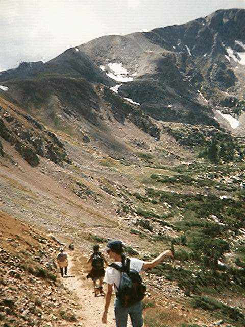
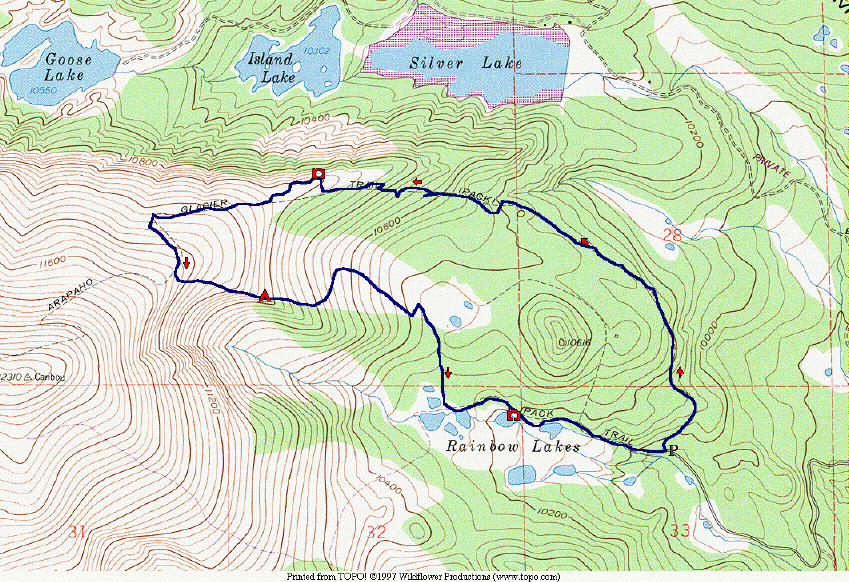
Arapahoe Glacier Trail (and Bushwhack Loop back to Rainbow Lakes)
Summary:
A forest trail emerges to a gorgeous overlook, part-way up toward
Arapahoe Peak. A bushwhack continuation descends an open meadow to a marshy pond,
then (rather inconveniently) follows a heavily forested stream down to a widely used trail
that connects the lakes. There is a remarkable variety of views and habitats along the full
loop.
Description:
Two trails branch from the Rainbow Lakes Campground,
southwest of the Univ. of Colorado Experimental Station and north of Caribou. One
proceeds about half-a-mile west up to a series of small, shallow lakes (the trail passes close
to at least two of them). The other proceeds north, curves around to the west, and ascends
some ridges toward Caribou Mountain. (Beyond our turn-around point, it reaches 12,700
feet, passes close to Arapahoe Glacier, then drops down to meet other trails at Arapahoe
Pass.) We describe a counterclockwise loop from these two trails, following the glacier
trail up and bushwacking down to the west end of the Rainbow Lakes Trail.
 Beginning at 10,000 feet it takes 2 hours to ascend, at leisurely pace, to a remarkable
viewpoint at 11,000 ft. Most of the climb is in rather monotonous forest. The first half-
hour is in fairly dense forest, proceding northerly. Shortly after encountering "No
Trespassing" signs for the City of Boulder watershed (which do not follow the actual
boundary between the Indian Peak Wilderness and the City of Boulder Watershed, but
rather hug the righthand portion of the trail much of the way), the well-built trail narrows
and briefly steepens, then the forest thins a bit (affording a few views) and the grade levels
out, with even a few gentle downhills. At the point where there is a prominent $100 fine
for trespassing sign, the trail switchbacks up to the left (south), away from the watershed
boundary signs, beginning a series of switchbacks up the south side of a major ridge.
Beginning at 10,000 feet it takes 2 hours to ascend, at leisurely pace, to a remarkable
viewpoint at 11,000 ft. Most of the climb is in rather monotonous forest. The first half-
hour is in fairly dense forest, proceding northerly. Shortly after encountering "No
Trespassing" signs for the City of Boulder watershed (which do not follow the actual
boundary between the Indian Peak Wilderness and the City of Boulder Watershed, but
rather hug the righthand portion of the trail much of the way), the well-built trail narrows
and briefly steepens, then the forest thins a bit (affording a few views) and the grade levels
out, with even a few gentle downhills. At the point where there is a prominent $100 fine
for trespassing sign, the trail switchbacks up to the left (south), away from the watershed
boundary signs, beginning a series of switchbacks up the south side of a major ridge.
Shortly before leaving the forested region, one can bushwack north, to the right, a few
hundred feet up to a cliff-edge (watershed boundary, again); or one can proceed on the trail
to the open country and backtrack a bit along the edge of the canyon. There are glorious
views in all directions, but mainly west toward the glacier and around to the north and
down toward Silver and Island Lakes. The trail then switchbacks up the lower flanks of
Caribou Mountain. At about 11,500 ft. elevation, we suggest following a contour off the
trail to some large, dark-green bushes, next to a major snowpack in a great bowl.
From there, instead of returning by the same route, the adventurous can bushwack
down toward two small northerly lakes in front of a prominent small peak. Stay near the
edge of the bowl, down to the first point of continuous dwarf forest. (That would be a
great tenting place.) The tundra gives way to deeper grasses with abundant flowers. On a
few occasions, in order to avoid getting trapped in low forest tangle, follow short animal
trails through to the next meadow. (The first, important connection is from a hundred feet
NW from the lowermost patch of short-grass tundra-meadow.) Finally, follow a small
rushing stream down through the woods to the Rainbow Lakes. There was no trail, but
there were routes, chiefly along the stream. (This is the most inconvenient part of the
route.)
The Rainbow Lakes trail proceeds east along the north sides of two nice lakes. The
trail is wide, but very rough, initially. It becomes smoother, probably an old road, then
diverts onto a newly-constructed single track for a while, before emerging again on the old,
wider trail. The bushwack down takes more than 1.5 hours, and the walk past the lakes
another half-hour. The total loop time, not counting stops, is about 5 hours to cover 4
miles.
How to Drive to the Trailhead:
This is reached, most readily, from the Peak-to-
Peak Hwy. turn-off (to the west) to the Colorado Experimental Station between Nederland
and Ward. In about a mile, the road branches: right to the Station, left (south) toward
Rainbow Lakes. We have found the gate to Rainbow Lakes closed at this point during
times when one might think it should be open. Less than a mile before the Campground,
FR 505 branches off to the left toward Caribou. Stay right.
 LYnda and Clark's Homepage.
Available Abstracts, Preprints, Articles.
Clark
R. Chapman's Publications.
Clark R. Chapman's Homepage.
SwRI Boulder Office
(Space Studies Dept.) Homepage.
SwRI Homepage